

Modern construction projects dig deeper than ever. Each new building, road, or infrastructure upgrade competes for space with a tangled network of cables, pipes, and conduits just beneath the surface. Before excavation begins, utility conflicts threaten project timelines, safety, and budgets. Over 20 million miles of underground utilities stretch across the United States alone, based on data from the United States Infrastructure Report Card (ASCE, 2021). Accidental strikes are costly-in 2022, utility damages caused over $30 billion in direct and indirect costs (Common Ground Alliance, DIRT Report, 2022).
This article addresses a pivotal construction technique: utility potholing. How can construction teams expose utilities with precision while minimizing damage? What best practices allow crews to uncover critical infrastructure before heavy equipment arrives? Dive in to discover proven potholing strategies, methods, and standards that safeguard both workers and subsurface assets. Are your current site investigation methods protecting your project’s schedule and bottom line?
Understanding Utility Potholing: Definition, Context, and Evolution
What Is Utility Potholing?
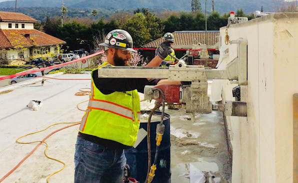
Utility potholing refers to a precise excavation process, also known as daylighting, that exposes underground utilities such as water mains, gas lines, electrical conduits, or fiber optic cables. Operators create a narrow, controlled hole down to the utility using methods like vacuum excavation or hydro excavation. This approach delivers a visual confirmation of utility location, positioning, and depth, which surpasses the accuracy of remote sensing technologies alone.
Potholing’s Place in Construction and Underground Utility Work
Direct excavation practices like utility potholing play a foundational role in major construction and infrastructure projects. When civil engineers, contractors, or utility companies receive design plans, those plans often show utilities based on past records or surface scanning. However, these records can deviate from reality due to undocumented changes, inaccurate mapping, or utility shifts over time. Potholing addresses these discrepancies by offering direct access to verify where each line physically lies within a job site. This discovery stage informs everything from trenching routes and foundation placement to safe boring or drilling operations. Errors in underground utility mapping have produced costly or dangerous incidents, which has driven widespread adoption of potholing prior to mechanical excavation activities.
The Evolution of Utility Potholing
Modern potholing evolved from manual hand-digging, which remains a time-consuming task and increases risk to both personnel and buried utilities. Advancements in vacuum and hydro excavation technology in the late 20th century transformed the approach, enabling non-destructive, highly localized subsurface investigations. By 2001, key industry standards-such as the American Society of Civil Engineers (ASCE) Standard 38-02-had formalized utility potholing as the highest standard (Quality Level A) for underground utility verification in subsurface utility engineering (SUE).
The Strategic Value of Utility Potholing in Construction Projects
Determining Success at the Planning and Execution Stages
Utility potholing serves as a foundational step during both the design and execution phases. Construction planners use potholing to accurately map the horizontal and vertical positions of underground utilities. This process delivers verified data that consistently reduces guesswork and the risk of clashes between new infrastructure and existing networks. When designers possess precise information, plans can be adapted to avoid utility conflicts, minimizing project delays and unplanned modifications.
Throughout execution, field crews benefit from clearly marked and exposed utility locations. They navigate site operations with higher confidence, preventing accidental strikes that can disable vital systems or endanger workers on site. Consider the impact: The Common Ground Alliance’s 2022 DIRT Report documented over 192,000 reported damages to underground utilities in the United States, with excavation work responsible for approximately 66% of these events. Systematically implementing potholing into construction protocol immediately curtails these figures.
Real-World Consequences of Detecting – or Missing – Utilities
Failure to perform utility potholing produces a cascade of costly and dangerous issues. When a backhoe severs an unmarked fiber optic cable, telecommunications outages can paralyze business operations across several city blocks. If a water main bursts during excavation because its location went unidentified, crews confront not just flooding and expensive pipe repairs, but also public health hazards and regulatory penalties.
-
Gas line punctures can trigger evacuations and, in rare cases, explosions-an event witnessed in Murrieta, California in 2019, where a gas line rupture led to a fatal blaze and forced the evacuation of nearly 1,000 people (Source: National Transportation Safety Board Accident Report, NTSB/PAR-20/01).
-
Electrical line damage interrupts power, disrupts nearby roadways, and may result in severe injuries to construction workers or the public. According to the Electrical Safety Foundation International, contact with underground power lines represents one of the leading sources of electrical fatalities in the construction sector.
-
Cut water and sewer lines produce not only site delays, but also expose workers to hazardous substances and environmental contamination-creating clean-up burdens and legal liabilities.
Which risks would you rather control: a known and mapped field of buried utilities, or hidden hazards waiting to halt your project?
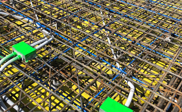
Protecting Every Type of Critical Underground Utility
The scope of protected assets during potholing is extensive. Gas conduits, pressurized water mains, buried high-voltage lines, fiber optic bundles, and copper telecom cables-potholing helps shield each from both structural damage and system service interruptions. Industry benchmarks reinforce this: The Federal Highway Administration confirms in their 2021 Subsurface Utility Engineering (SUE) Technical Report that utility strikes decrease by nearly 90% when potholing is consistently adopted alongside electronic location methods.
Successful teams use potholing to create safer jobsites, prevent regional utility outages, and ensure that critical infrastructure continues to serve communities. You drive project certainty when underground risks are turned into visible, manageable assets at the outset.
How Potholing Prevents Damage: The Groundwork for Safer Projects
Identifying and Locating Underground Utilities
Construction crews rely on precise data before breaking ground, but buried infrastructure introduces complex challenges. Potholing-by exposing, rather than merely detecting-removes guesswork. Hydro vacuum excavation, a common method, uses highly pressurized water and powerful vacuums to clear soil, exposing utilities with accuracy to within inches. The Common Ground Alliance reported in its 2022 DIRT (Damage Information Reporting Tool) analysis that when a facility is visually confirmed via potholing, the risk of utility strikes drops by over 90% compared to projects relying solely on utility maps or electronic locators.
Locators identify the precise horizontal and vertical position-known as XY and depth data-of power lines, telecommunications cables, water pipes, gas mains, and fiber optics. As a result, designers and excavators can confidently plan work zones, knowing exactly where hazards and assets lie in the ground.
Damage Prevention and Risk Mitigation
Every year, damages to underground infrastructure cost the U.S. economy billions. In 2021 alone, the Common Ground Alliance estimated costs from utility strikes at over $30 billion-a figure encompassing repairs, service disruptions, medical expenses, legal liabilities, and lost productivity.
Potholing minimizes these losses by giving crews unobstructed views of actual utility placements. When operators see a pipe, conduit, or cable surface before excavation proceeds, the likelihood of accidentally hitting it drops dramatically. For example, the American Society of Civil Engineers found that projects featuring potholing experienced 50-75% fewer strikes, depending on the utility type and site complexity. By physically verifying with potholing, crews can adopt tailored protective measures-changing dig depth, adjusting equipment, or rerouting planned work-right in the field.
Real-World Cases of Expensive Mistakes-and the Protection Potholing Provides
-
Seattle, 2016: An excavator ruptured a fiber optic communications line that had been incorrectly mapped. Emergency potholing after the incident revealed the true location, but not before the outage disrupted over 20,000 customers. Recovery costs, including emergency repairs and outage penalties, topped $1.4 million (source: Seattle Utilities Incident Report 2016).
-
Houston, 2019: Gas utility damage during new road construction led to a six-hour evacuation for hundreds of residents. Investigators determined no potholing was performed despite conflicting utility records. Had crews exposed the gas main, the interruption-and the $300,000 emergency response tab-would have been avoided.
-
Denver, 2021: Potholing identified shallowly buried electrical lines that did not appear in any plans due to prior undocumented upgrades. Construction managers altered the trenching plan on the spot, avoiding an outage risk and saving an estimated $250,000 in downtime and repairs.
Without potholing, costs escalate and timelines slide. Conversely, its adoption consistently delivers lower risk, smoother workflows, and more predictable budgets.
Modern Methods and Techniques: How Utility Potholing Gets Done
Manual Digging Approaches
Manual digging continues to serve as the oldest method for exposing underground utilities. Workers use shovels and hand tools to excavate small, precise holes directly above the suspected utility corridor. This technique minimizes the risk of damaging lines because the process remains slow and controlled. Crews often select manual potholing in locations with intricate networks or tight spatial constraints. When soil conditions allow and utility depth remains shallow (usually up to 1.2 meters), manual excavation offers an acceptable risk-reward profile, though labor demands are significant. Consider this scenario: Have you ever calculated the labor hours versus exposure accuracy for a trench just one meter wide? The result: manual methods require 4 to 8 worker-hours per meter of trench, based on industry reporting from the Common Ground Alliance.
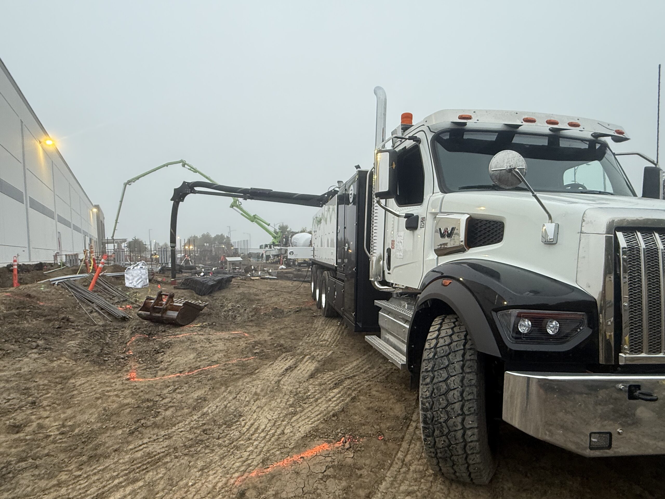
Vacuum Excavation Techniques: Hydro and Air Excavation
Vacuum excavation harnesses pressurized air or water to break up soil, while a powerful suction device removes the debris to reveal buried infrastructure. Two primary approaches define this method:
-
Hydro Excavation: Water under high pressure (generally 1,000-3,000 psi) loosens the soil. The slurry created is then quickly vacuumed to expose the target utility. Hydro excavation proves effective for frozen or compact soils and routinely delivers excavation rates of about 0.5 to 1 cubic meter per minute, according to International Society for Trenchless Technology.
-
Air Excavation: Compressed air fractures the ground, allowing a vacuum to remove dry soil. This technique keeps the spoils dry for easy backfilling and reduces the risk of erosion in the work area. Crews can safely uncover fiber optics, gas mains, and power lines with minimal chance of line breaks, averaging about 0.2 to 0.5 cubic meter per minute cleared, as per NULCA field performance reviews.
Contractors select between air or hydro systems based on soil composition, climate, and specific jobsite compliance standards.
Method Comparison: Safety, Speed, Cost, and Accuracy
-
Safety: Vacuum technologies greatly reduce human exposure in open trenches and present markedly lower utility strike risks than traditional hand digging. Manual techniques, although controlled, require workers to operate near buried utilities, increasing risk in congested corridors.
-
Speed: Hydro and air excavators routinely outpace manual labor. Field case studies from equipment manufacturers such as Ditch Witch report up to 60% faster potholing for medium-depth exposures when using vacuum solutions.
-
Cost: While upfront machine rental or purchase can reach $1,500 to $4,000 per day depending on model and region, vacuum excavation offsets this with reduced labor and lowered damage restitution claims. Meanwhile, hand digging costs scale directly with crew size and duration on site.
-
Accuracy: Both vacuum and manual methods achieve exposure accuracy of ±3 centimeters when performed correctly, but vacuum approaches enable cleaner, more consistent results with less backfill disruption, which accelerates surface restoration times.
Picture a construction schedule trimmed by several days because vacuum excavation exposed utilities with pinpoint accuracy. Which method would you choose for your next project, considering not only safety but also manpower allocation and compliance metrics?
Equipment Used for Utility Potholing: From Manual Tools to Advanced Vacuum Systems
Shovels versus Mechanical and Vacuum Equipment
Manual digging tools, such as shovels and hand trowels, remain in use for small-scale potholing tasks or where extreme caution is required. These hand tools reduce the risk of damaging nearby utility lines, especially in confined areas or when working near highly sensitive infrastructure like fiber optic cables. However, manual methods are far slower and labor-intensive compared to mechanical alternatives.
Mechanical diggers, including backhoes and mini-excavators, speed up the process, yet they bring a higher risk of striking underground assets. For this reason, many utilities and contractors prefer non-destructive equipment when working in congested zones.
-
Manual tools produce precise, small-diameter holes yet quickly become impractical for deeper or multiple potholes.
-
Mechanical excavation provides rapid soil removal but can cause catastrophic damage if operators misjudge utility locations.
-
Vacuum excavation systems have emerged as the preferred option for balancing speed and safety on most large or complex projects.
Hydrovac and Air-Vacuum Technology – How They Work
Hydrovac technology combines high-pressure water with a powerful vacuum to excavate soil. Operators direct a water jet to liquefy soil around suspected utilities; the resultant slurry is then vacuumed into a debris tank. The process exposes cables and pipelines without physical contact, reducing accidental strikes. Data from Common Ground Alliance (2023) confirms that use of hydro-excavation lowers utility damage rates compared to manual or mechanical methods.
Air-vacuum systems rely on compressed air rather than water. By blasting air into the soil, these machines break up and displace dirt, which is subsequently sucked up by vacuum. Air-vacuum excavation is ideal for sites where introducing water could disrupt sensitive soils or extend post-excavation cleanup. The American Society of Civil Engineers notes that air-vacuum gear retrieves dry spoil, facilitating immediate backfill and reducing downtime.
-
Hydrovac units efficiently cut through dense, compacted soils and clay-rich ground, making them suitable for urban construction zones.
-
Air-vacuum systems excel in sandy or granular soils and sensitive ecological or archaeological sites.
-
Both systems produce potholes with diameters typically ranging from 6 to 18 inches, optimizing visibility while containing surface disruption.
Selecting the Right Equipment for Specific Ground and Project Requirements
Equipment selection hinges on several key factors: soil composition, utility type and depth, local site constraints, and regulatory mandates. For example, hydro-excavation equipment will outperform air-vacuum machines in hard clay, but air-based systems reduce water use and facilitate immediate site restoration. Contractors assess each site’s unique challenges before mobilizing equipment.
As you consider which method suits your site, ask: How deep are the target utilities? Does the site demand low-impact techniques? Will groundwater or mess complicate water-based excavation? The answers will point to a tailored equipment approach.
-
Clay-heavy urban soil-opt for hydrovac systems for maximum efficiency and reduced manual labor.
-
Dry, sandy sites-deploy air-vacuum technology to streamline potholing without introducing moisture.
-
Heavily congested utility corridors-prioritize non-destructive vacuum excavation over mechanical methods to minimize repair costs and service disruptions.
Equipment advances continue to refine utility potholing: some modern rigs offer GPS integration and remote operation, raising productivity and data accuracy. As technology evolves, equipment choice becomes a project-defining factor, shaping both timelines and safety outcomes.
Critical Safety Considerations in Utility Potholing Work
Key Safety Protocols for Construction Teams
Thorough utility mapping and site surveys lay a strong foundation for safe potholing, ensuring crews know the precise location and type of utilities present before breaking ground. Construction teams use utility locating devices, follow detailed worksite checklists, and mark surfaces according to ANSI/APWA guidelines. Digging only within designated boundaries reduces accidental strikes. Adhering to the OSHA 1926 Subpart P regulations for trenching and excavation limits the risk of ground collapse and protects team members working within excavations deeper than 5 feet.
Teams frequently establish site-specific communication plans-a simple radio check or visual signal can prevent potential missteps near critical infrastructure. Assigning a competent person to each work zone, as recommended by OSHA, ensures ongoing hazard assessment and prompt response to emerging risks.
Proper Training for Workers Handling Utility Exposure
Construction companies that commit to comprehensive training see measurable reductions in on-site injuries related to utility exposure. Training covers the operation of vacuum excavation equipment, safe hand digging practices, and methods for identifying and verifying utility markings. Technical modules on live electrical lines and pressurized gas mains equip workers to detect danger before it materializes. According to the Common Ground Alliance DIRT Report 2022, job sites with regular hands-on training recorded a 58% lower rate of utility strikes compared to those with limited education.
-
Mandatory annual refresher courses keep safety procedures top of mind.
-
Site-specific hazard briefings prepare crews for unique risks.
-
Mock drills instill a culture of readiness and rapid response.
Common Risks: Collapse, Gas Leaks, Electrical Hazards
Typical hazards in utility potholing include ground collapse, accidental gas leaks, and contact with energized electrical lines. Trench collapses remain a leading cause of fatalities in excavation work-OSHA attributes over 20 trench-related deaths annually in the United States to insufficient protective systems or disregard of trench safety rules.
Gas leaks, which often occur when high-pressure mains are exposed or compromised, produce immediate risk. Prompt detection relies on atmospheric testing instruments, and the deployment of intrinsically safe tools minimizes the chance of ignition. Electrical hazards present a severe threat in urban corridors. Data from the U.S. Bureau of Labor Statistics (2023) shows that electrocutions account for approximately 7% of construction fatalities, frequently resulting from inadvertent contact during potholing operations.
Have you implemented a specific protocol to check for these hazards before the first dig? Teams that integrate real-time hazard monitoring technology with traditional safety checklists experience fewer incidents and keep projects on schedule.
Potholing Regulations and Compliance: Standards, Permits, and Documentation
Relevant Standards: OSHA and Local Codes
Federal and state regulations enforce strict requirements on potholing and subsurface utility exposure. The Occupational Safety and Health Administration (OSHA) in the United States, for example, establishes minimum clearance distances from existing utilities. OSHA Standard 1926.651(b)(1) mandates the exact location of underground installations must be determined by safe and acceptable means when employees are in proximity to these systems. Many states, including California and Texas, have adopted even more stringent utility locating laws under “One Call” or “811” guidelines, requiring contractors to notify utility operators at least 48 to 72 hours before excavation begins.
In addition to OSHA federal standards, municipal and state authorities enact local construction codes regulating exposure depths, method selection, and engineering controls during potholing procedures. Failure to comply with these regulations will result in project delays, substantial fines, and in some cases, stoppage of all work on-site.
Documentation and Reporting Requirements
Regulatory agencies require thorough and timely documentation throughout the potholing process. Contractors must maintain detailed records that typically include:
-
Field sketches and GIS data: Exact location and depth of exposed utilities, annotated onto site maps or integrated with project geospatial systems.
-
Photographic evidence: High-resolution photos documenting the exposed utility before and after excavation.
-
Daily activity logs: Chronological record of work completed, crew members present, weather conditions, and protective measures in use.
Some jurisdictions mandate submission of final reports to permitting agencies, and larger infrastructure projects require digital records stored in project management platforms.
Permit and Service Mark Out Process
Permit acquisition stands as another regulated component of potholing. Before commencing work, contractors apply for excavation permits from municipal or state authorities. This involves submitting project plans, insurance certificates, and a scope of work outlining potential impacts on public infrastructure.
The “mark out” process, also known as service locating or utility notification, forms a critical risk mitigation step. State and federal 811 “Call Before You Dig” programs require that utility owners mark the location of their underground utilities on the job site, usually within two business days of notification. Painted lines, colored according to the American Public Works Association Uniform Color Code, distinguish water, gas, electric, telecommunications, and sewer lines.
-
Orange: Communications, Alarm or Signal Lines, Cables, or Conduit
-
Red: Electric Power Lines, Cables, Conduit, and Lighting Cables
-
Blue: Potable Water
-
Green: Sewers and Drain Lines
-
Yellow: Gas, Oil, Steam, Petroleum, or Gaseous Materials
After the mark out, the contractor may legally proceed with potholing, in compliance with all markings and issued permits. What steps can your project team take to ensure 100 percent documentation and regulatory compliance? Consider assigning a dedicated compliance officer or adopting a digital documentation tool for real-time recordkeeping and reporting.
Unraveling the Cost and Time Factors of Utility Potholing in Construction Projects
Analyzing Direct and Indirect Costs
Direct costs in utility potholing include equipment rental or purchase, labor wages, and professional utility locator fees. A single vacuum excavation unit typically rents for $400-$600 per day, while skilled operators command hourly rates between $35 and $55 based on region and prevailing wage agreements (source: EquipmentWatch, 2023). The process often necessitates two to three technicians on site, increasing labor outlays on larger projects.
Indirect costs frequently surface as project downtime and administrative overhead. When heavy equipment idles during utility verification, productivity decreases; a 2017 Common Ground Alliance report estimates that utility strikes cost the U.S. construction industry $1.5 billion in direct repairs annually, but indirect costs-such as idle time-can double that figure. Every extra day spent awaiting potholing data can ripple through the project schedule, affecting subcontractor timelines and equipment utilization.
Measuring Time Savings Versus Potential Delays
Contractors face a clear trade-off: invest time in potholing or risk unforeseen utility strikes that halt operations entirely. According to an American Society of Civil Engineers study, projects incorporating potholing into preconstruction may add 2-5% to the project timeline for the utility locating phase. Yet, the same research documents a 30-50% reduction in major schedule disruptions, with a typical utility strike causing multi-day shutdowns for repairs and regulatory investigations.
-
Hydro excavation can expose an average utility in 60-90 minutes, compared to several hours using traditional hand digging.
-
The Federal Highway Administration (FHWA) found that for every dollar spent on utility location, $4.62 is saved in reduced delays and avoided rework.
-
Projects avoiding potholing often encounter unplanned stoppages adding up to $10,000-$100,000 per incident, depending on damage severity and site location.
Given these figures, teams weighing the up-front time outlay against the risk of costly project delays find a compelling argument in favor of potholing.
Budgeting for Utility Potholing Services
Establishing a realistic utility potholing budget involves assessing site complexity, the density of underground utilities, and project timelines. Industry data from RSMeans (2023) places the average utility potholing cost at $400-$1,200 per test hole, influenced by technique (hydro-vac vs. hand digging), soil conditions, and location.
-
Urban projects with heavy utility congestion generally budget for a higher volume of test holes-engineers often specify a minimum of one pothole every 30 linear meters of trench.
-
Remote or low-density utility corridors may see fewer test holes, but difficult terrain can drive up per-hole costs due to slower excavation rates.
Smart cost allocation covers not just field work but associated safety, traffic control, and regulatory requirements. Have you reviewed your project’s utility maps and cross-matched with a potholing estimate? Integrating these line items into the preconstruction phase ensures transparency during project bidding and can mitigate disputes later.
Precision Planning: How Utility Potholing Shapes Project Schedules
Integrating Potholing into the Project Scope
Incorporating utility potholing during the earliest stages of project planning will immediately add clarity to the scope of work. Project managers include potholing in the initial proposal documents and scope-of-work statements, ensuring that both costs and timelines reflect this investigative phase. Clients and construction firms who plan for potholing up front gain the benefit of accurate underground utility location data, which supports the development of detailed project execution plans.
Determining the Right Moment: Scheduling Potholing Activities
Potholing must occur before any excavation, foundation work, or trenching begins. Placing potholing activities within the pre-construction phase eliminates the risk of last-minute utility conflicts. Engineers and schedulers allocate time for potholing after utility locators have identified potential areas of concern, but before mobilizing heavy equipment. For example: The American Society of Civil Engineers reports that unplanned utility strikes account for direct costs of $1.7 billion per year in the United States, while investing in early potholing avoids such incidents, prevents costly rework, and eliminates discovery delays (ASCE, 2022). How do you currently sequence subsurface investigations on your projects? When does your team factor utility verification into the schedule?
Effective Communication: Sharing Utility Data with Stakeholders
Project success depends on efficient information-sharing. As potholing crews uncover utilities, their verified data must move quickly to engineers, supervisors, and subcontractors. This immediate dissemination-often via cloud-based platforms or shared digital survey files-prevents miscommunication and reduces on-site confusion. After potholing, updates to utility maps and construction plans take place, and teams adjust their workflows based on the new information. Consider how regularly updated data leads to seamless coordination: construction phases proceed without delay, change orders diminish, and risks associated with unknown utility locations decrease sharply.
-
Are your teams prepared to adjust the project timeline once potholing reveals unexpected utilities?
-
How robust is your internal process for updating and sharing critical site data?
-
Who in your organization owns the responsibility for integrating potholing results into daily operations?
Collaboration: Utility Locators and Construction Teams
Optimizing Workflow for Precise Digging and Utility Identification
Construction projects frequently depend on seamless cooperation between utility locators and construction teams. Early in the workflow, utility locators perform site surveys to identify the presence and approximate routes of buried utilities. These findings dictate the next steps. Construction teams then reference locator flags and ground markings to guide excavation. Effective communication enables real-time adjustments-should unexpected obstacles emerge, both parties adapt quickly, minimizing delays and preserving utility integrity. Have you considered how a misstep in this process can drastically disrupt your project timeline?
Achieving Accurate Marking, Mapping, and Record-Keeping
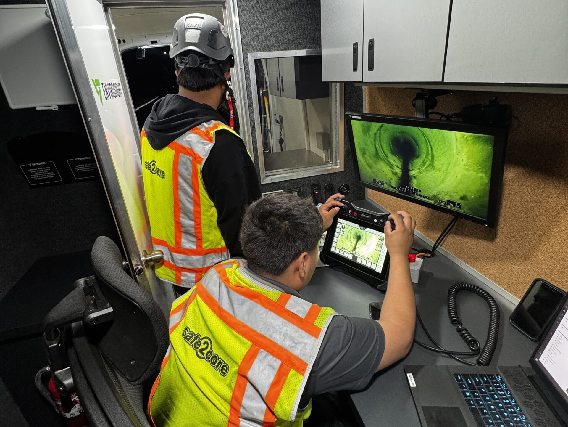
Accurate documentation provides the backbone for all subsequent excavation work. Utility locators generate digital or physical maps, integrating GPS data and as-built records to produce up-to-date, site-specific utility maps. Construction teams cross-reference these maps prior to each digging phase. Many organizations implement redundant marking-spray paint, stakes, or electronic markers-to reinforce visibility in variable site conditions. Sophisticated software platforms, such as GIS (Geographic Information Systems), are employed to maintain real-time records and enable fast data sharing among stakeholders.
Defining Roles and Responsibilities at Each Project Stage
-
Pre-Excavation Planning: Utility locators scan and document subsurface infrastructure, sharing precise coordinates and safety constraints with project managers.
-
On-Site Verification: Both teams participate in a “white lining” or pre-marking meeting, reviewing all provided data to approve dig sites and techniques.
-
Ongoing Supervision: Construction crew leaders monitor digging progress in tandem with locators, ensuring utilities are exposed without damage. Locators remain on call to assist if unexpected lines or changes in markings arise.
-
Post-Excavation Documentation: Updates to utility records and maps reflect any adjustments discovered during potholing. All teams sign off on site reports, closing the loop for project compliance and future reference.
Each phase demands distinct expertise, but only rigorous collaboration produces reliable outcomes. Which practices have proven most effective for your team during high-stakes utility work?
Environmental Considerations in Potholing
Minimizing Ground and Surface Disruption
Controlling the extent of soil and surface disturbance during utility potholing protects existing ecosystems and infrastructure. Unlike traditional excavation, hydro and vacuum excavation methods create openings as small as 12 to 18 inches in diameter, reducing land disruption by as much as 90% compared to open trenching. When crews target utility locations with precise directional equipment, they leave surrounding root systems and pavement intact, lowering the risk of collateral damage to nearby vegetation and property.
Managing Byproducts from Vacuum Excavation
Vacuum excavation produces spoils, including wet mud, water, and loosened soil. Effective management begins at the site. Vacuum trucks with dual onboard tanks segregate liquid and solid byproducts during the process. After extraction, teams collect and transport spoils to regulatory-compliant disposal facilities. Municipalities such as the City of Seattle require all slurry materials to meet Wastewater Discharge Requirements before entry into public treatment systems. Consider these strategies for controlling byproduct impact:
-
Deploy silt socks, berms, or spill mats to prevent runoff into storm drains or waterways.
-
Store contaminated water and soil separately for analytical testing, when relevant regulations apply.
-
Send non-hazardous material to approved landfills, and treat contaminated spoils according to EPA criteria, including TCLP (Toxicity Characteristic Leaching Procedure) if necessary.
How do your local ordinances guide the handling of excavation byproducts? Reviewing city-specific rules leads to compliant and environmentally responsible job sites.
Restoring Disturbed Areas for Minimal Project Footprint
After exposing utilities, restoration crews repair or replace surface coverings-such as asphalt, sod, or decorative brick-immediately or as the project schedule allows. When contractors use subgrade stabilization or seed new vegetation, they directly reintegrate the work zone into its surroundings. For example, the use of native grass seed blends after topsoil replacement can achieve 90% ground cover within a single growing season, according to research by the University of Minnesota Extension. Comprehensive restoration strategies often include:
-
Regrading and compacting soil back to original contours to prevent subsidence.
-
Applying erosion-control blankets in areas susceptible to runoff, such as slopes and streambanks.
-
Reinstating impermeable surfaces in accordance with Department of Transportation standards.
Which restoration methods align best with the environmental sensitivities of your project site? Reflecting on this question shapes sustainable utility locating practices from planning to closeout.
Best Practices for Utility Potholing
Pre-Dig Risk Assessment and Site Review
Thorough risk assessment before digging lays the foundation for safe and successful potholing operations. Field teams review current utility maps and consult with asset owners, analyzing all available data to identify potential risks. Utility maps, however, often miss undocumented or relocated lines. To address these gaps, experienced crews perform visual inspections of the site, scanning for visible infrastructure clues, marker posts, and manhole covers. Team discussions, fueled by insights from local utility providers, help anticipate challenges such as congested corridors or areas with historical relocations. Have you ever encountered unexpected utilities during excavation? Bringing those experiences into pre-dig meetings sharpens everyone’s risk perception and response strategies.
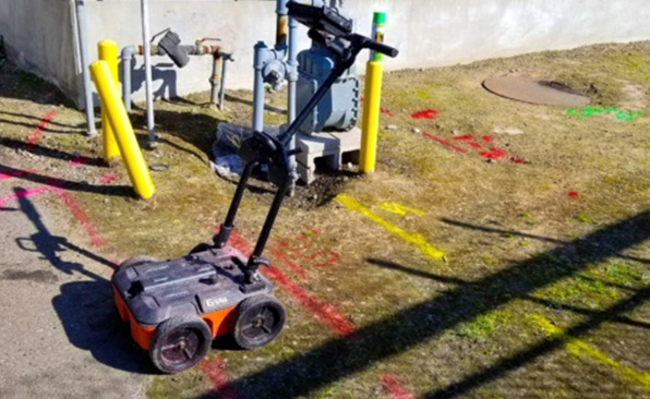
Layered Verification: Combining Ground-Penetrating Radar and Potholing
No single detection method captures every underground utility. Combining technologies produces robust results. Teams often deploy ground-penetrating radar (GPR) to survey sites first, creating a real-time subsurface image that highlights buried anomalies and potential conflicts. This layered approach continues as verified GPR results inform precise potholing locations, optimizing efficiency and eliminating guesswork. When hydro excavation or vacuum excavation exposes the utility physically, it resolves any uncertainties from digital mapping or electromagnetic locators. How do teams confirm findings? By matching the physical characteristics of exposed utilities against service records: pipe size, material, and depth. GPR data accuracy for metallic pipes reaches over 90%, according to the Common Ground Alliance DIRT Report 2022, but direct exposure with potholing achieves certainty.
Continuous Safety Monitoring and Updated Service Records
Safety monitoring does not pause once work begins. Safety officers conduct ongoing walkthroughs while watching for hazards such as unexpected ground settlement, pressurized lines, or weather impacts. Interactive checklists and digital inspection logs help teams track compliance and document real-time findings. When utilities are exposed, crews update service records immediately-marking exact location, depth, material, and condition of lines. These updates feed back into digital utility mapping tools, reducing future uncertainties for all stakeholders. What could change on-site within hours? Soil stability, weather conditions, and even shifts in construction phasing can alter working environments and present new risks-prompting continuous adaptation.
-
Start with comprehensive risk identification. Harness insights from maps, visual site surveys, and utility owner consultations.
-
Use both detection and verification tools. Begin with ground-penetrating radar but always confirm findings by physical potholing.
-
Update service records in real time. Capture new information as utilities are uncovered, ensuring future construction projects have access to accurate, on-the-ground data.
-
Maintain continuous safety vigilance. Adapt to site changes and document findings to keep all team members prepared for surprise encounters.
Bringing together these best practices, project leaders and field crews streamline work, minimize downtime, and optimize safety. What adjustments can your team make to strengthen its utility potholing process?
Breakthroughs in Utility Potholing: Next-Generation Technologies Driving Efficiency
Revolution in Excavation: Vacuum and Hydro Excavation Equipment
Manufacturers have introduced vacuum and hydro excavation units with sharper precision and greater power. Today’s truck-mounted systems deliver airflow rates exceeding 5,000 cubic feet per minute (CFM) and water pressures up to 4,000 psi, allowing crews to expose buried lines with minimal disturbance to surrounding soils. For example, innovative debris tank designs can now handle over 12 cubic yards of spoils, increasing productivity by reducing the need for frequent unloading trips. With more precise nozzles and advanced filtration, hydro excavators can work efficiently in tight urban areas or highly sensitive environments.
Digital Mapping: Accurate Data Collection in the Field
Field teams carry portable Ground Penetrating Radar (GPR) devices that transmit data in real time to Geographic Information Systems (GIS). Crews scan the subsurface, and project managers immediately see utility locations displayed on digital maps, reducing guesswork and rework. Augmented reality tools, such as Trimble SiteVision, overlay GIS data directly onto the excavation site through tablets or smart visors. This integration eliminates conversion errors and enhances collaboration between surveyors and equipment operators.
-
LiDAR systems mounted on potholing equipment scan excavation sites, collecting millions of measurement points per second. This produces 3D terrain models usable for clash detection and future planning.
-
Cloud-based utility mapping platforms, including GPR mapping integrations, permit instant updates and team access, so changes reach every stakeholder without delay.
Automation and Safety: Smarter, Safer Utility Exposure
Remote control systems and obstacle-detection sensors now equip leading potholing rigs. Operators can position and maneuver the vacuum arm from a safe distance, minimizing manual labor around open holes and pressurized lines. Sonic sensors, infrared cameras, and proximity alarms actively warn workers about unexpected underground objects or equipment movement, reducing incidents dramatically. For instance, manufacturers such as Ditch Witch offer real-time vacuum pressure monitoring and auto-shutoff features that activate during pressure spikes to prevent accidental bursts.
-
Wearable proximity sensors transmit location data, triggering warnings if team members approach dangerous zones during excavation.
-
Automated spoil handling reduces exposure to hazardous materials; collection units lift and deposit spoils into sealed containers without direct worker contact.
-
On-board diagnostics enable remote system checks and predictive maintenance, increasing uptime and reducing breakdowns in field operations.
Which of these innovations would make the biggest impact on your next jobsite? Imagine coordinating with digital maps that update live as you excavate-what new efficiencies could your projects unlock?
Case Studies and Real-World Examples: Potholing in Action
Rapid Transit Expansion, Los Angeles: Preventing Multimillion-Dollar Interruptions
Los Angeles Metro’s Regional Connector Transit Project faced a critical challenge during tunneling operations in 2018. Construction teams identified potential conflicts with century-old water and telecommunication lines beneath downtown streets. Through precision potholing, field teams positively located 42 utilities at intersections slated for excavation. This effort eliminated uncertainty and enabled sequential relocation. As a direct result, the project team avoided accidental line strikes that, based on American Public Works Association data, would have resulted in emergency repairs averaging $35,000-$60,000 per incident and days of lost productivity per strike. Since the connector would serve up to 90,000 riders daily, uninterrupted construction maintained commuter access and public trust.
Highway Widening, Dallas: Averting Catastrophic Service Outages
TxDOT’s I-635 Express project integrated vacuum excavation potholing along the entire 11-mile corridor. Field data showed that potholing revealed previously undocumented fiber-optic conduits at five separate locations. By targeting these zones, the project team adjusted bore paths and realigned pavement cuts. Telecommunications providers confirmed that a single fiber cut could have disrupted internet and voice services for over 250,000 residents and 4,000 businesses. These findings echo industry trends: according to the Common Ground Alliance’s 2022 DIRT Report, utility strikes cost the U.S. economy more than $30 billion annually, highlighting the economic magnitude of proactive potholing.
Urban Redevelopment, Chicago: Documenting Unmapped Assets
Redevelopment of the Chicago Riverwalk demanded meticulous planning in dense, decades-old infrastructure corridors. In 2021, potholing crews uncovered a cast-iron water main not present in city records. The unexpected find forced a real-time revision of design documents and prevented line rupture during excavation, which historically sets back projects by 4-8 weeks for emergency repairs and permitting. Team debriefs showed that each pothole exposed saved approximately 12 staff-hours in project delays, based on internal cost tracking.
Lessons Learned and Takeaways for Construction Managers
-
Potholing eliminates guesswork. Reliable, verified utility locations allow for confident design adjustments.
-
Real-world cases show cost savings not just in avoided repairs, but also in protected schedules and maintained public services.
-
Cross-sector collaboration-utilities, contractors, and city engineers-accelerates problem solving when unforeseen obstacles arise.
-
Comprehensive documentation ensures that future infrastructure upgrades encounter fewer surprises, smoothing long-term urban development.
The Vital Edge: Embracing Utility Potholing in Modern Construction
A construction project that integrates utility potholing elevates accuracy, protects utility service, and reduces costly disruptions. By physically exposing utilities before digging, project teams dramatically reduce strike incidents, ensure the safety of both personnel and infrastructure, and build schedules grounded in real data. Vacuums and other specialized equipment facilitate a non-destructive approach, mapping underground utilities with a level of certainty that other methods cannot match.
Would your next ground-breaking benefit from verified utility locations? Consider how the most efficient work today prioritizes pneumatic or hydro vacuum potholing techniques, bringing both construction teams and utility owners into closer collaboration. Success in utility work does not rely on chance; it originates from experience, precision, and proven best practices.
Reach out to a specialized utility potholing service provider on your upcoming project. How will this shift in approach redefine your team’s safety, efficiency, and reputation in the field?